Get wind speeds directly from your design code, via SkyCiv’s interactive design wind speed map
Calculating wind loads is not always an easy process. That’s why SkyCiv has integrated an interactive wind speed map to help engineers pull wind speeds on various locations from simply entering in a site location. Currently, the wind speed map supports the following design codes and site locations:
| Design Standard | Countries/Regions Supported |
|---|---|
| ASCE 7-10 ASCE 7-16 ASCE 7-22 |
United States American Samoa Guam Puerto Rico U.S. Virgin Islands |
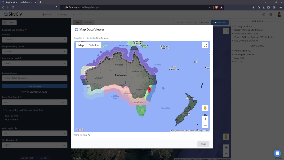
| AS/NZS 1170.2 (2021) | Australia New Zealand |
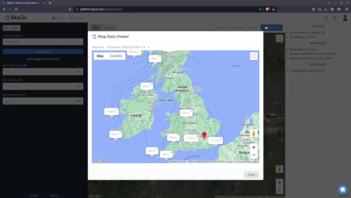
| EN 1991-1-4 | Belgium Czech Republic Finland France Germany Greece Ireland Italy Luxembourg The Netherlands Poland San Marino Singapore Slovakia Slovenia United Kingdom |
| NBCC 2015 NBCC 2020 |
Canada |
| NSCP 2015 | Philippines |
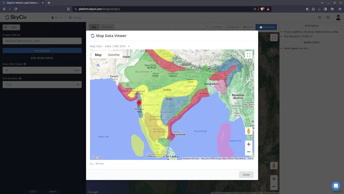
| IS 875-3 | India |
| CTE DB SE-AE | Spain |
| CFE 08 CFE 20 |
Mexico |
| UNIT 50 | Uruguay (mobile version) |
| NSR-10 | Colombia (mobile version) |
| ABNT NBR 6123 | Brazil (mobile version) |
Need to determine the basic wind speed for a specific location? Download SkyCiv mobile app now and use our Mobile Load Generator to automatically get the basic wind speeds per location!
SkyCiv’s Design Wind Speed Map
By simply entering the project address, Zip Code or city (or even click-dragging the red pin) – the wind speed and elevations will immediately display on both the map (via a dialog box) and the left column input fields. These values can be changed at any time for use with the ASCE 7, AS/NZS 1170.2, NBCC 2015/2020, NSCP 2015, CTE DB SE-AE, CFE 08/20, or EN 1991-1-4 pressure calculations.
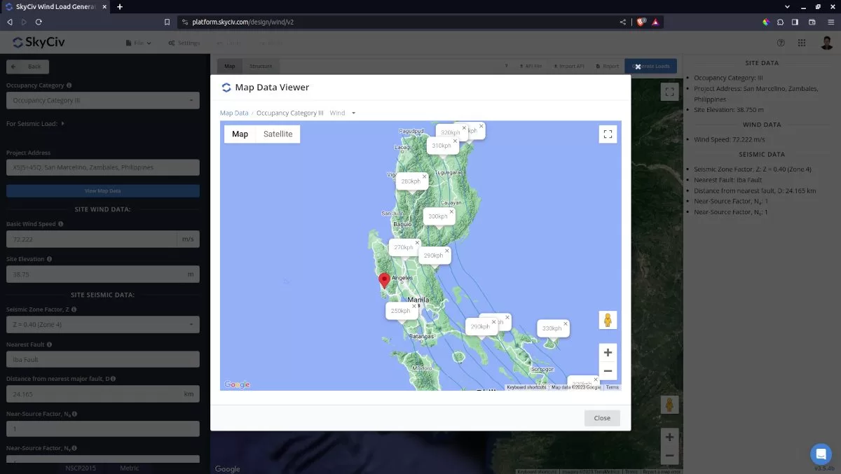
The various design code wind speed zones have been digitized and rebuilt as this interactive wind speed map for engineers to get accurate wind speeds by locations. The free tool allows up to 3 entries per day before it requires you to sign up for a SkyCiv Free Account. However the wind speed map can only be accessed for users with Professional account and Load Generator standalone subscribers. From here you can make as many calls as you like to get the wind speeds of various locations.
Basic Wind Speed Calculation
SkyCiv digitized the wind speed maps for each reference code and converted it to GeoJSON files. These files are then processed at the backend using the Google Maps API and other geospatial analysis libraries to process the wind speed values. There are two ways how the basic wind speeds are calculated. First is depending on whether the location is inside the wind region/zone with specific wind speed value (AS/NZS 1170.2, NBCC 2015/NBCC 2020, IS 875, CTE DB SE, EN 1991, and CFE 08/20) and the second is interpolating the wind speed value from wind contours (ASCE 7-10/ASCE 7-16/ASCE 7-22, NSCP 2015, BS EN 1991-1-4, I.S. EN 1991-1-4, and NBCC 2015/2020).
For the first method, it will check if the latitude and longitude of the site location is inside one of the wind region polygons. If the location is inside the region or zone, it will get the corresponding wind speed value for the region or zone. Note that the boundaries of these converted wind speed map were simplified to optimize the calculation of this process. For an instance, an island is represented by a simplified polygon covering the whole area instead of using the shoreline. An example of this method is applied to IS 875-3 Wind speed determination.
For wind contours, the SkyCiv Load Generator use the points of these polylines to create Triangulated Irregular Network (TIN). Then the solver will iterate on these created triangles to check whether the latitude and longitude of the site location is inside one of these polygons. Once it detects the triangle where the site is located, it will interpolate the wind speed value from the 3 known value points. An example of this method is implemented in ASCE 7-10/ASCE 7-16/ASCE 7-22, NSCP 2015, BS EN 1991-1-4, I.S. EN 1991-1-4, and NBCC 2015/2020 wind speed determination.
Speedup your wind and snow load calculations! Generate detailed wind and snow load report from a few inputs!
Verification
ASCE 7 Wind Speed
Wind speed data from select locations can be viewed below compared with the ASCE 7 Hazard Tool and ATC Hazard Tool. This is for ASCE 7-10, ASCE 7-16, and ASCE 7-22.
In conclusion, wind speed maps are important for structural engineers to design buildings as per the site location. The engineer will start by getting a design wind speed to use as the basis of their future design pressure calculations.
If you’re looking for examples on how to calculate wind design pressures from design wind speeds, please visit one of the following articles:
- ASCE 7-10 Wind Load Calculation Example
- AS/NZS 1170.2 Wind Load Calculation Example
- EN 1991-1-4 Wind Load Calculation Example
- IS 875-3 Wind Load Calculation Example
- ASCE 7-16 Wind Load Calcultion Example for L-shaped Building
Get all the functions of SkyCiv including the Load Generator!